TRAVEL
enhance your experience...
KNOWLEDGE
make it much more comfortable...
INFORMATION
helps you to find things...
RomWell Travel Advisory
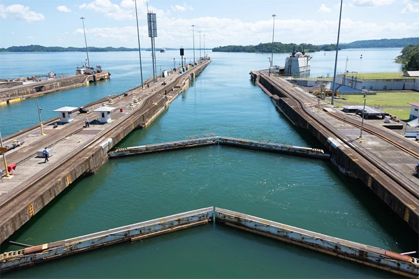
The Panama Canal is an amazing feat of engineering that all travelers should try to experience at least once in a lifetime.
For centuries the dream was to unite the two great oceans of the world, but it took an unparalleled engineering triumph and an international work force to finally construct the Panama Canal.
Since opening in 1914 the Panama Canal has been acclaimed the world over as one of mankind's greatest endeavors. Today, it is held in awe as one of the wonders of the modern world - a place of serene natural beauty, as well as political and commercial importance. Despite its importance as a trade route, travelers are being attracted to the area for what lies on either side of the great passageway. The fabulous ports of the Caribbean on the east of the canal and on the west, the Pacific, Costa Rica, Guatemala and Mexico. The area is truly traveler's dream.
Completed in 1914, the Panama Canal has saved every ship passing through it a 7,872-mile trip around South America. Now, each ship takes a 51-mile journey through an intricate system of gates, locks, and drains. A single trip through the canal requires 52 million gallons of water, and busy days can see up to 40 trips. For the water it needs, the canal depends on one of the world's biggest artificial lakes: Gatún Lake. For its water supply, Gatún Lake depends on the health of the surrounding rainforest.
In Panama’s healthy rainforest, rainwater saturates the soil, then feeds the streams supplying Gatún Lake. In the last few decades, however, logging and slash-and-burn agriculture have claimed half of the surrounding rainforest. Deforested land cannot absorb the region’s heavy tropical rains; the excess water floods Gatún Dam and flows out to sea. The floodwaters also fill the lake with sediment. Dredging the lake bottom has restored its storage capacity, but also forced local residents to filter the lake water or rely on bottled drinking water. Learn more...
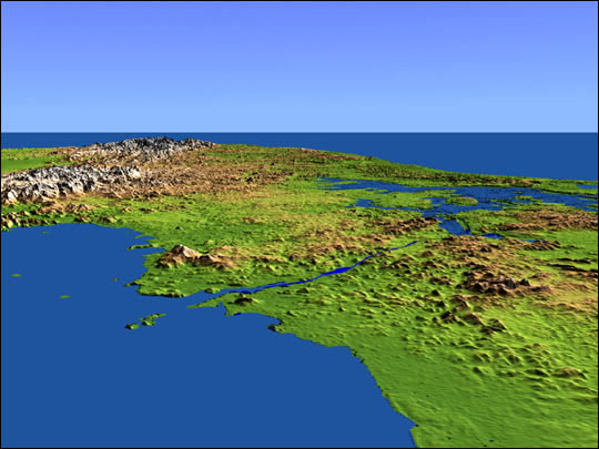
This perspective view shows the Panama Canal with the Gulf of Panama in the foreground and the Caribbean Sea in the distance. The canal runs northwest-southeast from the city of Colon on the Atlantic side to Panama City on the Pacific side. Water levels are maintained along its length by three reservoirs, the largest of which is Lake Gatun, visible at the right center of the image. Built by the U.S. Army Corps of Engineers between 1904 and 1914, the canal extends for approximately 50 miles and is widely considered to be one of the world’s great engineering achievements. Find more info...
Image Courtesy SRTM Team NASA/JPL/NIMA. Click on the image for bigger topographic image.
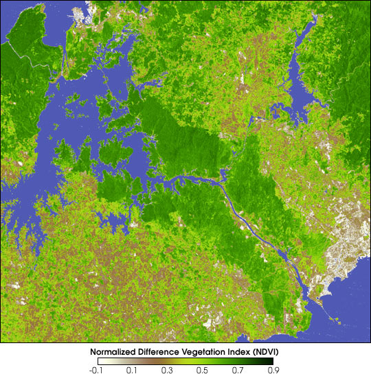
The rainforests of Panama, in particular, are some of the world’s most biologically diverse areas. Chagres National Park, situated east of Gatun Lake and the northern half of Panama Canal, has 1,185 species of plants, 130 of which are unique to that area. Panama’s rainforests are home to many mammals that migrated from both North and South America. Click on the image for bigger topographic image and click on the link to find out more about Rainforests of Panama
Image by Reto Stockli, NASA Earth Observatory
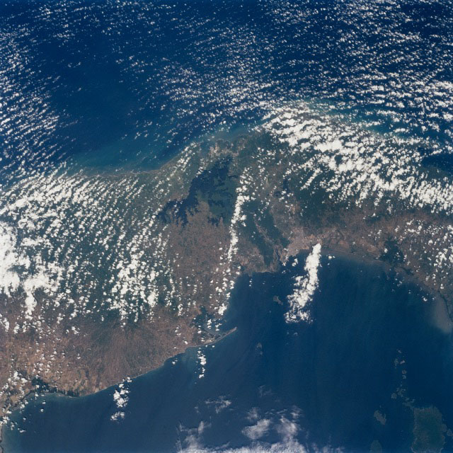
Near the center of this north-looking image, the forested area of the Panama Canal Zone can be seen. The Panama Canal Zone extends 5 miles (8 km) on either side of the Panama Canal.
The Panama Canal is 40 miles (64 km) long including dredged approach channels at each end. Click on the image for bigger topographic image. Click on this link to find out more...
Image From: Image Science and Analysis Laboratory, NASA-Johnson Space Center. "The Gateway to Astronaut Photography of Earth."
The Panama Canal is also strategically very important, being the only crossing point from the Atlantic and Pacific without going south around the tip of South America via Drake Passage; a notoriously dangerous stretch of sea.
Surprise your loved ones with great craft creations, decorate your house, or make unique gifts for any occasion and create ultimate gift giving experience. Save money, spend a quality time with your dearest ones, and have fun doing great craft for any occasion!
Find out more